Automatic Address Searching & Geocoding +WKT files
How to best enter your address data for mapping functionality
Required System Role: Standard User
Required Team Role: Contributor
Automatic Address Searching & Geocoding
Our Address component allows Users to quickly enter address details, searching an international database of locations to add address details automatically to the other address fields.

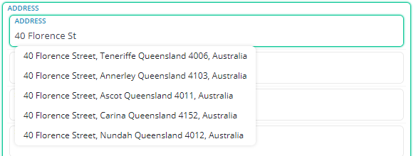
When you open a record with the option to add an address, simply start typing in your address into the address field, and the automatic search will begin giving you options that match your text.
Note: This will try and prioritise options located in your current time zone.
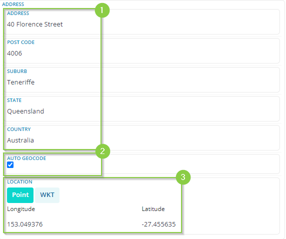
Once you see the address you are after, clicking that option will automatically fill in the address fields (1).
The system will automatically geocode (2) the address to enable the record to be located on the mapping tools in the system by their longitude and latitude (3).
Note: De-selecting the auto geocode box will tell the system to not geocode this record.
If the system is unable to find your address automatically, fill in the address fields as best you can and the system will try its best to find the most accurate coordinates for what has been entered.
Tip: If you need to enter an apartment or a townhouse, search for the street address first, select it to fill out the rest of the details, and then you can edit the address field to include the apartment number.
You are able to use the WKT (Well-Known Text) format to enter geographical locations as Lines or a Polygon (5), just get your WKT files and put them in the text box below (6).
WKT files can be really useful to mark large Property boundaries with no clear geographical centre or Project Boundaries. The WKT files are flexible and will allow you to input both lines and polygons. Please reach out to us or your mapping team to get more information for potential use cases.

